Landscapes
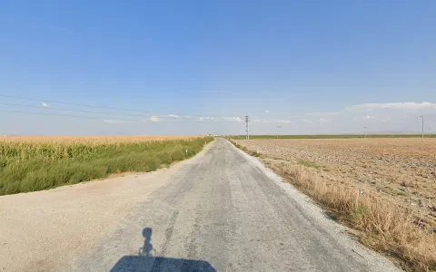
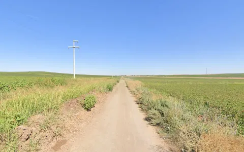
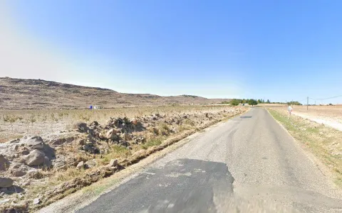
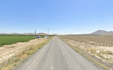
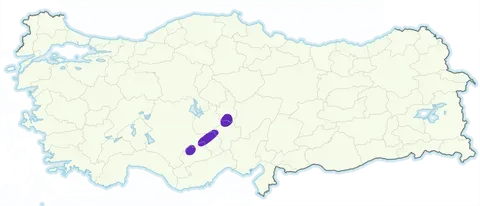
The Konya plain is the flattest part of Turkey and also very green and agricultural in relation to other parts of the Anatolian plateau. Note that the plain stretches east from Konya to the city Karapinar.
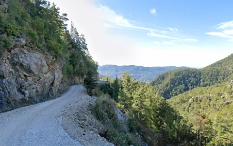
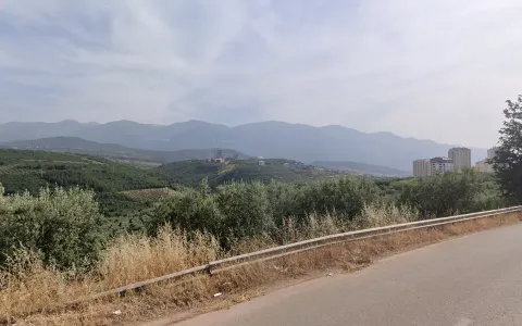
Much of Antalya province is very recognisable for its forests composed entirely of Turkish pines combined with a rocky karst landscape.
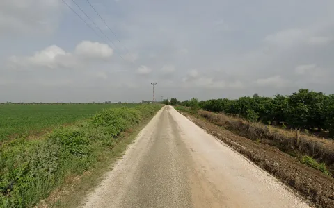
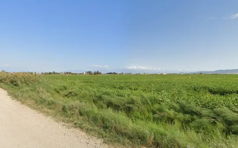
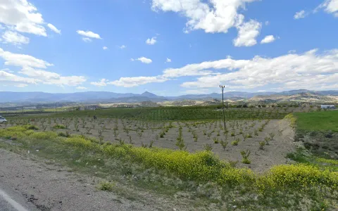
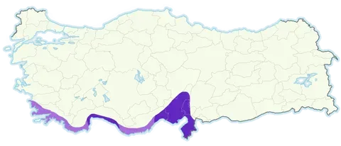
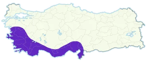
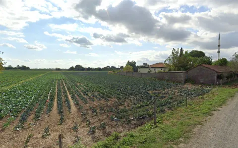
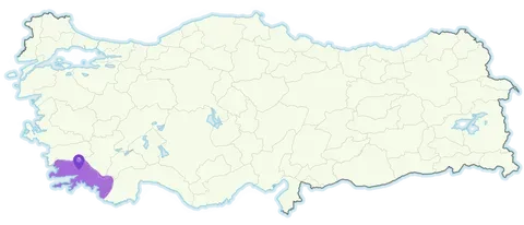
The southwest is dead flat with very mixed agriculture consisting of different fruit and vegetable fields as well as cotton and corn, with subtropical plants such as eucalyptus, palms and reeds being common in between. Mountains will normally be visible to the northwest.
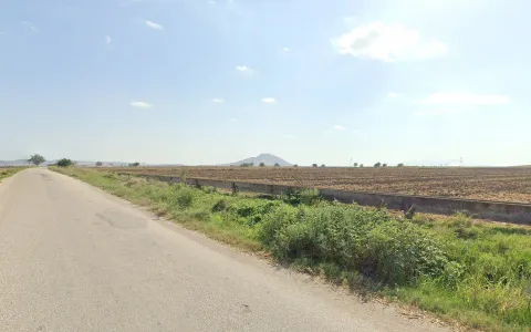
The northeast is similar, with a very flat landscape, however here you will find fewer subtropical plants, and more temperate crops such as low vegetable fields and fallow corn fields. Mountains will be visible to the east.
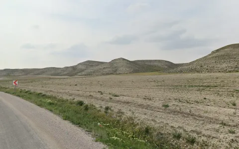
The southeast is similar to the northeast but has a number of isolated peaks which stand out from the deadflat plain.
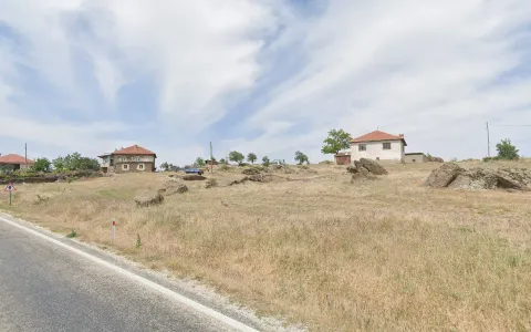
The northwest is composed of gentle rolling hills, often with fruit or olive plantations but mostly just fallow wheat/sunflower fields.
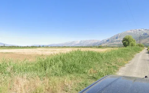

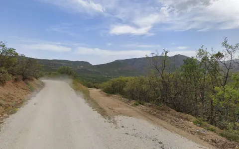
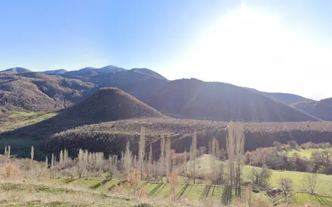
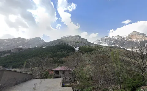
Erzincan is situated in a relatively narrow plain with particularly high mountains on both sides, with high peaks to the northeast and southeast. The valley also has a moderate amount of tree cover with black poplars and willows being common.
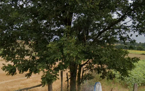
Tunceli is unusually green for an eastern province. It is distinguishable from other forested parts of the country as its forests consist exclusively of oak trees, with slightly reddish soil and exposed dark grey mountain sides further confirming the province.
The Eastern Taurus are the high mountains that form a chain roughly from Bingöl to south of Lake Van. Like Tunceli, they also form islands of forests in the Southeast, although the soil is less red and the whole region is visibly drier. The valleys will also be full of black poplars.
Diyarbakır province is mostly covered by a flat plain, one of the largest in the dry southeast. It is very distinguishable for the complete lack of trees, and gently rolling golden hills of wheat, distinguishing it from the deadflat regions bordering Syria. The southern third of this plain has darker soil and is mostly used to grow cotton.
Eastern Mardin has a very distinct landscape of low, craggy hills covered in stone walls and scattered vegetation.

The only similar area to Eastern Mardin is the hills of Kilis and Gaziantep. The key difference is that these hills are volcanic, meaning the stones and soil are darker, and you will also find more agriculture and fewer scattered bushes in the shallow valleys.

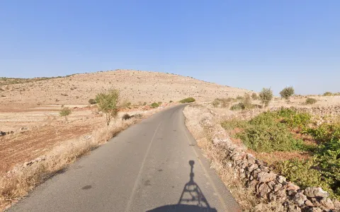
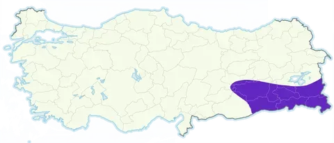
Eastern Hatay has a super flat landscape, however unlike the Central Plateau, the soil here is quite red and you will always be able to see mountains to your east & west. It can be divided in two parts - the southern half is wider and more featureless, with mountains often quite distant.
Meanwhile, the northern half going into Gaziantep forms a more narrow valley with mountains clearly visible on either side. Here you will also find rock walls made of large orange boulders, as well as a more rocky landscape more generally.
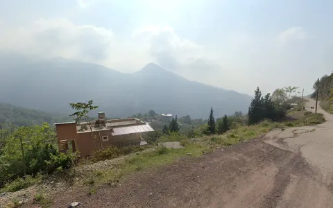

The Nur Mountains run the length of Hatay Province. They are identifiable in a few ways - metal mesh poles and flat-roof houses in a green mountainous setting are especially common in Hatay. Another distinct feature of these mountains is how ‘high up’ many rounds seem. While the Nur mountains are not the highest, they rise extremely precipitously, appearing incredibly tall when looking down at the coast.
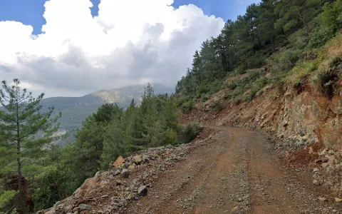
Over Musa Dağ, one of the tallest mountains in the range and the westward promontory of the Hatay peninsula, you can find a few roads with very distinct dirt road coverage through heavy high-mountain pine forests.

North of the city of Malatya is a relatively large flat agricultural area which can look very uncharacteristic for the east. Most of Turkey’s apricots are grown here, so recognising apricot trees can help, otherwise you may be able to see dry mountains from the area, which should indicate you are in Malatya rather than other fruit-producing regions.
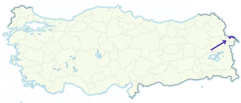
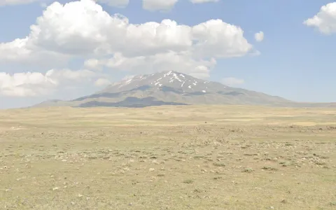
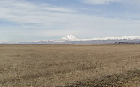
Most of Iğdır province is covered by the Arax plain, shared with Armenia. Here you’ll find a flat landscape of grassy fields and loads of black poplars. The best indication for Iğdır is Mount Ararat to the south, if visible. Besides the landscape, Iğdır villages mostly consist of plain, grey brick houses and metal roofs. Tall haystacks are also common.
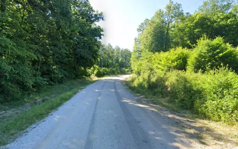
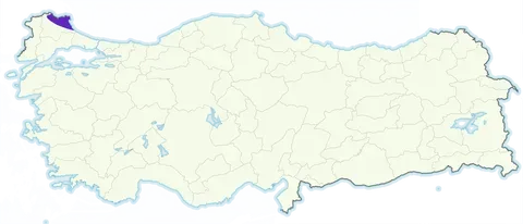
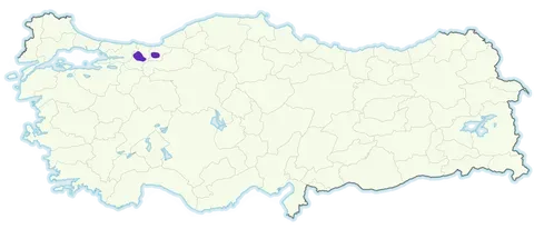
Strandzha is a coastal hill range on the Bulgarian border. It consists of low but very green hills, however it can be extremely difficult to tell apart from the rest of North Turkey. Besides a general ‘European forest vibe’, other clues for Strandzha are small, empty grassy clearings by the roadside, young cottonwood plantations, and yellow bollards (not exclusive to Kırklareli, but very common here).
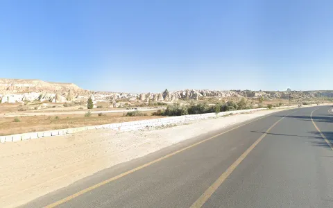
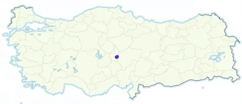
Cappadocia is a very unique and famous area in Central Turkey just east of Nevşehir which is highly distinct for its ‘fairy chimneys’. In the absence of these you can still identify the region through it’s exposed hillsides made of pink and white rock and general ‘Utah-like’ landscape.
Around the town of Mut in western Mersin province, you’ll find a unique karst landscape of white soil with a mix of conical and table mountains and generally crazy topography, all surrounded by fruit tree plantations.
The Karaburun Peninsula is one of the most mountainous parts of the west coast, and has a unique landscape of either low spongy bushes or olive plantations, and many wind farms. The southern part of the peninsula is less mountainous but has a lot of small rocks all over the ground.
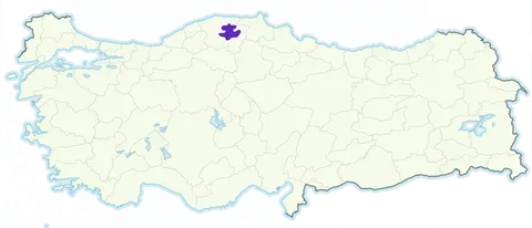
Kastamonu is essentially a small plateau within the northern mountains, which is drier and more piney than anywhere else in the north, with a landscape of agricultural, gently-rolling hills, with taller, greener hills visible in the distance. The northern half of the plateau around Devrekani is distinct for its mixture of bare ground with exposed rocks and dry all-pine forests.
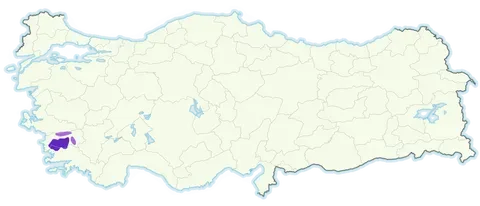
The Menderes Massif is a unique geological area covering much of Aydın province. Here you’ll find a lot of grey boulders and exposed rock, leading to the construction of lots of stone walls also. Stone pines are also exceedingly common in this region.
Uşak sits on an ancient volcanic basin (technically an extension of the Menderes Massif) meaning you will see a lot of scattered rocks on the ground, although these are lighter in colour than in the Menderes Massif. (This is quite subtle but still useful in flatter, more agricultural areas).
There is a large area between the cities of Ankara and Eskişehir that is full of these low hills with exposed white hillsides, with a generally green, agricultural, but mostly treeless landscape beside it. A smaller cluster of these exposed hillsides can be found in Çankırı province, where they are more pronounced and have marked striations.
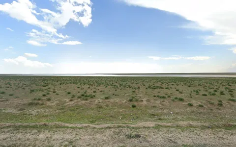
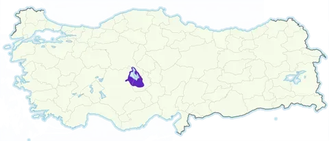
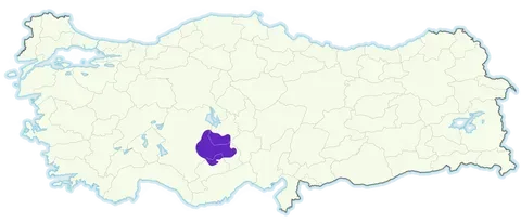
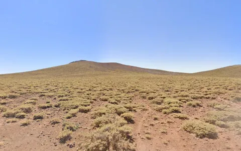
In the middle of the Anatolian plateau you can find a number of salt pans, the largest being Tuz Gölü (lit. ‘salt lake’) at the tripoint of Konya, Aksaray and Ankara provinces. Around these lakes you’ll find a dead flat, pale landscape with almost no vegetation apart from thistles. Sometimes the lakes themselves are visible.
Stretching from Southern Nevşehir to Karapınar in Konya province are a range of long-extinct volcanoes. In the flatter parts between these volcanoes you’ll find numerous isolated, smooth-sloped volcanic hills which are largely unique to this area.

Karacadağ is a wide, gently-rising volcanic hill with a unique barren, red soil and bushy landscape. The hill itself can be recognised from afar as gently rising with a black stone peak. The area around it is also covered in volcanic rocks. Fun fact, it is on the slopes of this hill that the first evidence of wheat domestication was discovered.
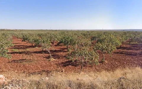

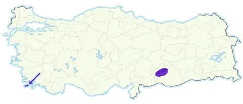
North of Gaziantep, leaking a bit into Şanlıurfa province, you can find extreme dark red soils, mostly covered in pistachio or olive plantations.
Mountains
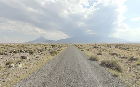
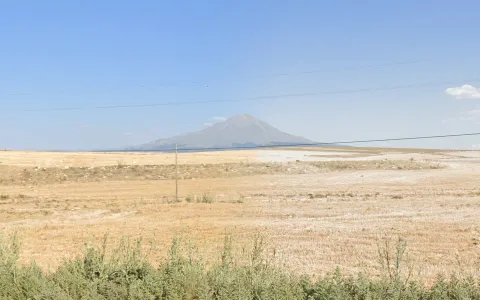
Mount Ararat is the tallest peak in Turkey and the tallest in the Middle East outside Iran. It is particularly recognisable as it also has a prominent secondary peak called Masis. It is situated near the Armenian border on the border between Ağrı (its Turkish name) province and Iğdır province.
Mount Erciyes is the second tallest volcano in Turkey after Mount Ararat. It is located south of the city of Kayseri where it can be seen for some distance, and is particularly identifiable for the numerous volcanic ridges and sub-peaks surrounding the main peak (which is usually not visible).
Another important volcano is Hasandağ southeast of the city of Aksaray. Unlike Erciyes it is a more clear cone volcano and due to the dryness of Aksaray province its peak is more likely to be visible.

Süphan Dağı is an isolated, snow-capped volcano on the northern shore of Lake Van, which makes it an excellent reference point for pinpointing your position on the lake, but also for the remote dirt roads to the north of the mountain.

Köse Dağı is the highest peak of the Aras range, located to the northwest of the Ağrı valley. Being far more prominent than the surrounding peaks, and having a relatively smooth shape, it is a good way to identify the valley.

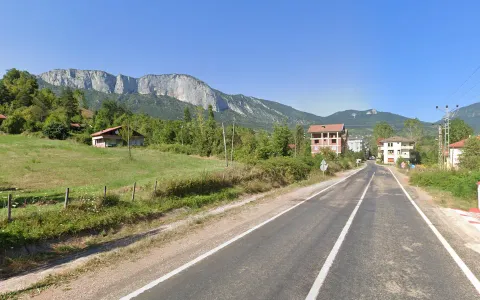
Uludağ is the highest mountain in the northwest of Turkey. It is useful for identifying Bursa and the plain around it, as the mountain creates a huge, cloud-shrouded wall to the south.
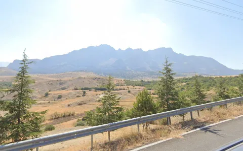

In Aladağları Milli Park (National Park) you will find a huge steep wall of mountains to your east which is highly recognisable, even from some distance.
Medetsiz Tepe is one of the highest massifs in the Taurus Mountains forming a fairly long, roughly east-west ridge, which is visible from a stretch of the D750 and some remote villages and mountain roads as a wall of snow-capped mountains to the south.
Within the northern forested mountains of Turkey there is one area that is topographically very different from the rest, situated in Bartın province very near the coast covered by the Küre Mountains National Park. What’s unique about these mountains is that they form a plateau with steep cliffs on most sides which are visible from numerous angles, very different from the interlocking peaks in the rest of the north.
Lakes

Burdur is a saline lake in the west of Turkey, and therefore contained within a valley surrounded by mountains (unlike the salt lakes of Central Anatolia). The only other such lake is Acı Gölü just north of it.
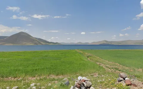
Balık Gölü is one of two lakes in far eastern Turkey (beside Lake Van) situated within a pristine, green steppe-like environment. The other is Çıldır Gölü, the main distinction being that Balık Gölü is smaller and surrounded by mountains.
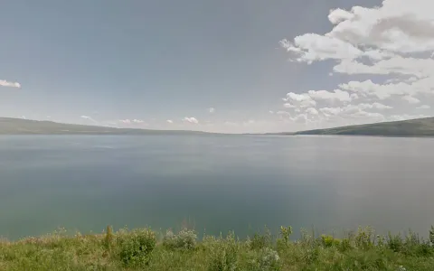

Çıldır Gölü is the other far-eastern steppe lake, situated much further north near the Georgian border. It is larger, greener, and surrounded by gentler slopes.
City Hills

The city of Afyonkarahisar has numerous small but steep-sided hills in the middle of town that can appear very close even on very urban rounds.
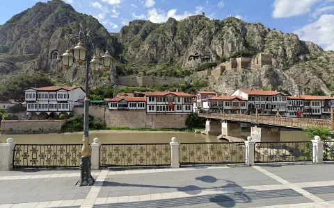
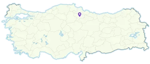
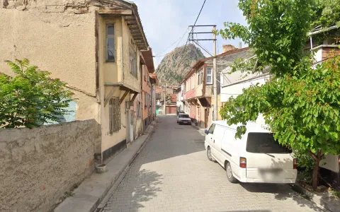
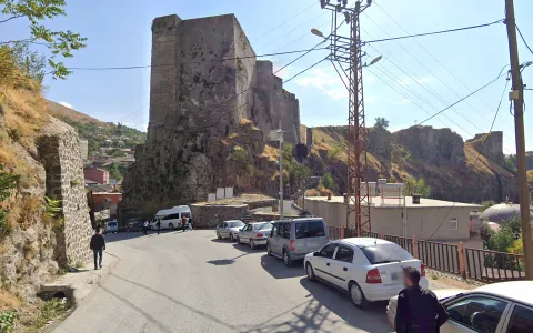
The city of Amasya is tightly bound within a valley surrounded by rocky hills. The city centre is overlooked by a hill with a castle on top and imposing Pontic tombs carved within it.

Bitlis is one of the smallest provincial capitals. It is a very green city surrounded by dry mountains. The city itself is also very historical, with a huge castle in the middle and lots of old stone mosques.
Vegetation
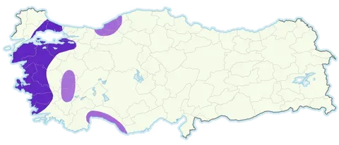
Stone pine (Pinus pinea) can be recognized by its rounded crown, where all the branches and needles are concentrated towards the top of the tree. It is found predominantly along the west coast.
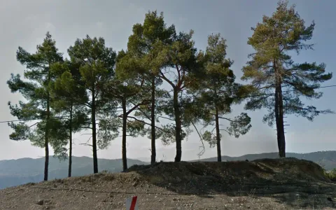
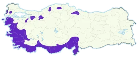
Turkish pine (Pinus brutia) is perhaps the most difficult pine species to identify in Turkey. It tends to have a less dense crown and brighter needles than other pines, the bark can be brown and can sometimes have a red tinge, but there is no stark contrast between the bottom and top sections of the trunk as there is with Scots pine. It is mainly found along the south and west coast.
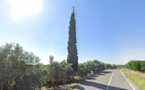
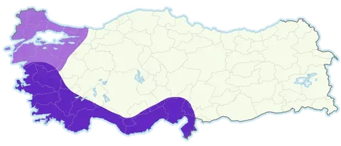
Mediterranean cypress (Cupressus sempervirens) is a conifer tree that features a very sharp crown resembling a spear and is mainly found along the south coast and the southern west coast, but also less commonly in the northwest of the country.
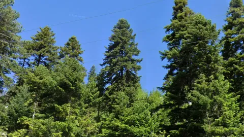
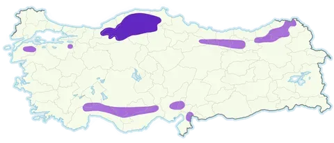
Firs (Abies spp.) are difficult to tell apart from other conifers, but the biggest clue lies in their branching structure, each branch coming off the trunk shaped like a flat fan. When viewed from the right angle you can often see the layers of flat branches stacked on top of one another. This contrasts with the branching structure of spruces, where secondary branches usually droop down from the primary branch. It is most common in the central northern mountains.
Hungarian oak (Quercus frainetto) is one of several oak species found in Turkey and can be recognized by the shape of its leaves. It has typical oak leaves, but they are larger and more deeply lobed than on other oak species.
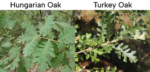
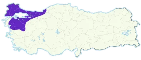
Not to be confused with Turkey oak, which has similar but smaller leaves with smaller lobes and is found in many more regions throughout the country. Hungarian oak by contrast is exclusive to the northwest of the country.
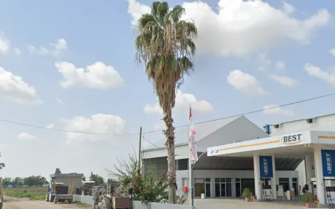
Fan palms (Washingtonia robusta) are, as the name suggests, palms featuring fan-shaped leaves and are a good clue that you are somewhere along the south coast, especially around the cities of Antalya and Adana.
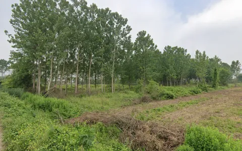
While poplar plantations can be found here and there in most temperate parts of Turkey, large orderly plantations are particularly common in the Düzce and Sakarya valleys.
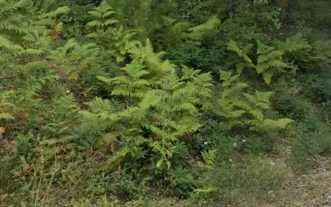
Ferns in Turkey are mainly found along the north coast and less commonly in other coastal areas.
Alder (Alnus glutinosa) can be recognized by its round leaves and pronounced leaf veins. It is very concentrated in the northeast of the country.
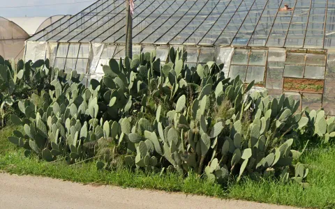
Prickly pear (Opuntia ficus-indica) is a type of cactus that consists of flat round pads and is found along the south coast and southern west coast.
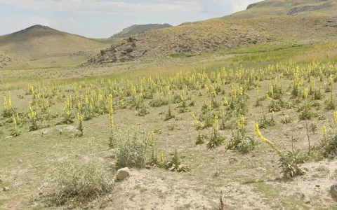

In northern Van there are numerous remote/dirt roads with ‘yellow flower spam’. Known as mullein (Verbascum sp.), it is very distinct for its tall stem with yellow flowers all along it.
Agriculture
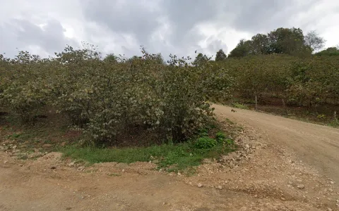
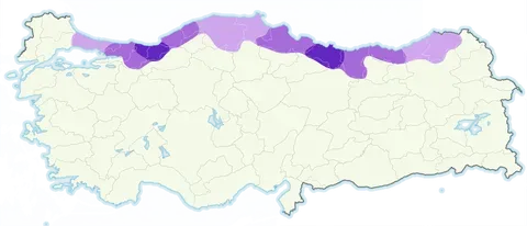
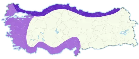
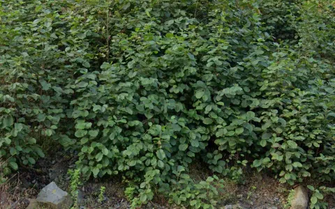
Hazelnuts absolutely dominate the landscape of much of the forested northern parts of the country. It is cultivated throughout the coastal hills from Kocaeli province all the way to Artvin, however it is especially dominant in Ordu, Giresun and Sakarya (usually in the latter province they are found in a flatter landscape). Hazelnut trees can be identified by their multiple thin stems emanating from a single point and round leaves. Hazelnut-covered mountains are even distinct from afar as they have a seemingly fuzzy texture with a sort of green-purple colour.
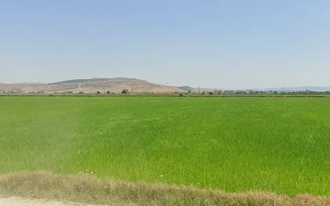
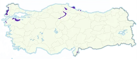
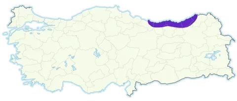
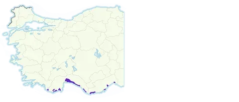
Rice is most common along the Greek border, and in northern Balıkesir, however it can be found in a few other distinct hotspots in the flat ‘deltas’ of Samsun province, numerous river valleys in Çorum, Sinop and Çankırı, and eastern Hatay.
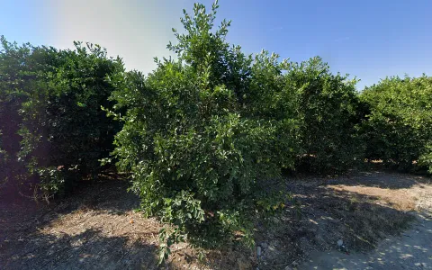
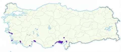
Citrus plantations are found on much of the Mediterranean coast from Aydın all the way to Hatay, being most common in the Adana plain.
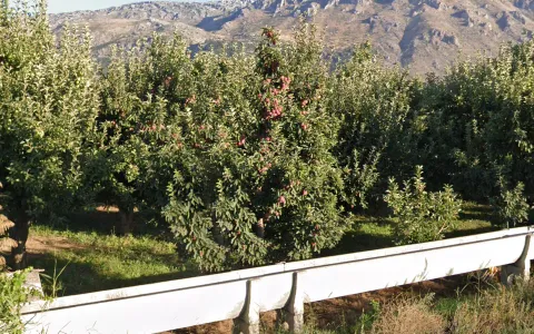
The valleys around Eğirdir Gölü in Isparta account for most of Turkey’s apple production.
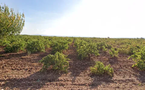
Besides the dense vineyards of the Alaşehir valley, there are a few other grape producing regions of Turkey. Just east of this valley, north of Denizli, is a unique red soil landscape with low, sporadic vineyards. There are also vineyards in the valley near the Gaziantep-Hatay border, particularly just south of İslahiye, as well as small isolated vineyards spread around Thrace and Cappadoccia.
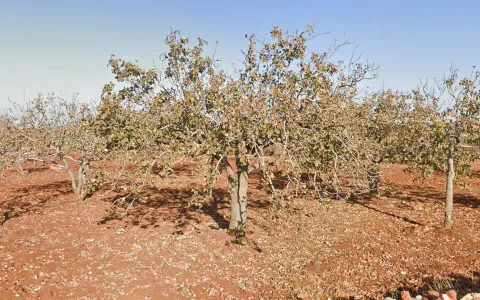

Pistachios are mainly grown around Gaziantep.
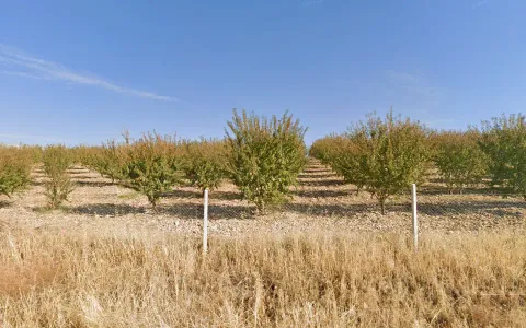
Almonds are a decent meta for Adıyaman province when found in isolated plantations. Another noteworthy hotspot in the southwest however is the Datça peninsula where they grow abundantly.
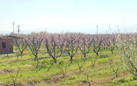
Cherries are mainly produced in three distinct areas - the Kemalpaşa valley just east of İzmir, the Sultandağı valley stretching south to Akşehir and the Bursa valley just northeast of Bursa city, where it grows alongside many other fruit. Cherries can be recognised in spring by pink cherryblossoms and in summer by their short trunks and tall branches with long droopy leaves.
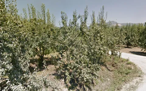

Pears are mostly produced in the aforementioned Bursa valley.
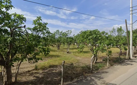
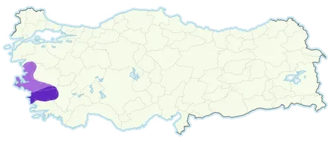
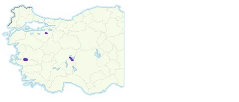
Aydın province produces 70% of Turkey’s figs, with most of the rest produced just across the border in İzmir.

Samsun province produces the vast majority of Turkey’s cabbages, and most of those are produced in the flat Bafra district that sticks out from the coast.

White opium poppies are cultivated in the valley around Afyonkarahisar, and they are very recognisable. A good mnemonic for this is that the name ‘Afyon-kara-hisar’ literally translates as ‘opium-black-fortress’.
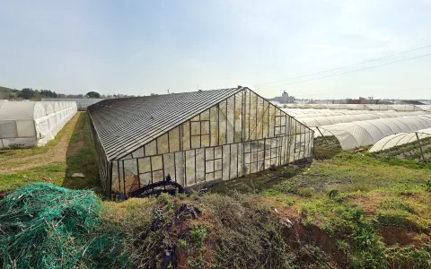
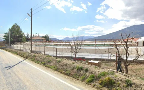
Along the southern coast of Turkey you will find numerous dense clusters of plastic and glass greenhouses. The westernmost of these clusters is around Kınık on the Muğla-Antalya border and the easternmost lies just east of Mersin. Note that individual greenhouses can be found all over the country, it is best to use this meta if you find greenhouses on multiple sides.

Greenhouses in a drier, more inland landscape, often without roofs, are common in the Elmalı valley and neighbouring inland regions of Western Antalya province.
Architecture
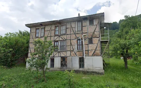

In Düzce province, you can often find clean timber-framed houses with well-defined edges and colours.
Kastamonu timber-framed houses often feature a pattern of downward-pointing bricks.
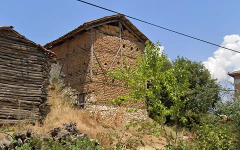
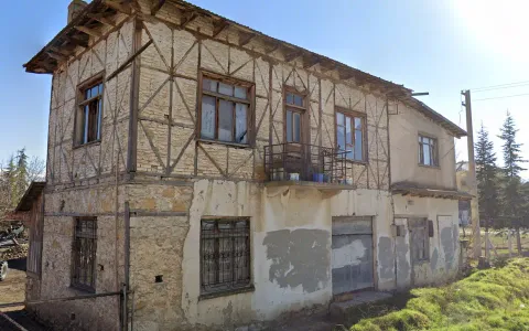
In Bilecik and large parts of neighbouring provinces like Bursa, Bolu and Sakarya, you can commonly find the combination of timber-framed houses with mud bricks.
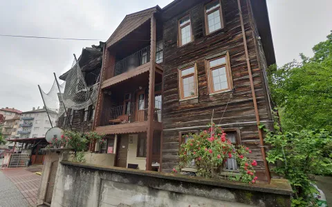

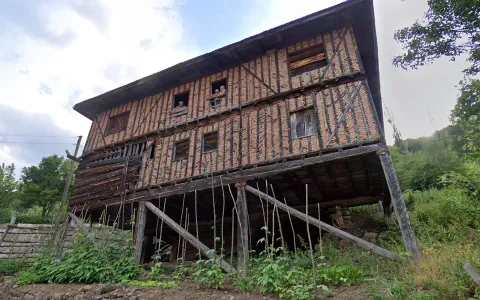
In older parts of Bartın you will find many old all-wooden houses.

One noteworthy cluster of wood-framed houses outside the northwest is in the Elmalı valley in Antalya province. Here the frames are notably intricate with many small beams packed together and eight beams meeting at one point - rare in the NW.
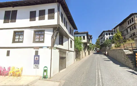
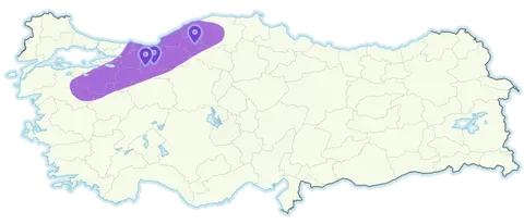
Ottoman architecture is characterised by plain-white walls with wooden window frames and shutters, as well as wooden outlines on most (but not all) buildings and an overhanging second floor. It correlates well with the original homeland of the Ottomans in the Northwest (particularly around Bolu). Some historical towns (e.g. Safranbolu, Taraklı) even have predominantly Ottoman architecture.
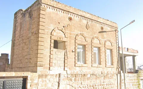
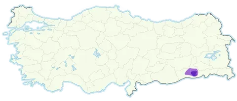
Tur Abdin is a cultural region in Eastern Mardin centered around Midyat. It is the cultural center of Syriac Orthodox Christianity and many buildings here have a very unique design defined by blocky buildings made of “Malta stone”, rich decoration and frequent use of balustrades. There is also a rarer “diamond stone” wall type that is found here.
The architectural influences of this area extend beyond it too. Certain features such as the stone type and prominent arches, as well as twin semi-circle windows on façades, extend into villages in southern Batman too.
Whereas the northwest of Turkey features a lot of traditional architecture with wooden elements, the northeastern coastal hills (roughly from Ordu province eastwards) feature almost entirely concrete buildings even in remote villages, as the extreme humidity of this region makes more traditional materials less viable.
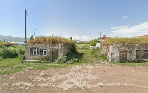
In the inland northeast of Turkey it is very common in villages to find low stone structures with grass roofs – these are mostly storehouses although rarely they constitute actual houses.
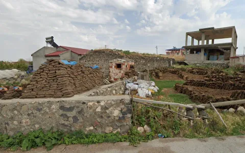
In remote villages in far eastern Turkey you can find cow dung being used as a construction material, mostly for walls. Cow dung “bricks” or “slabs” are often kept in large, very recognisable piles.
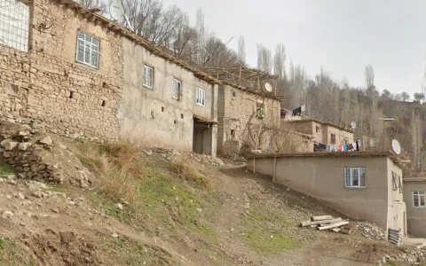
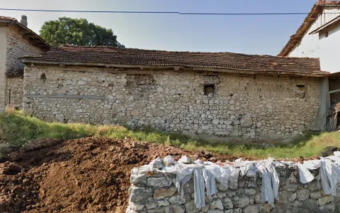
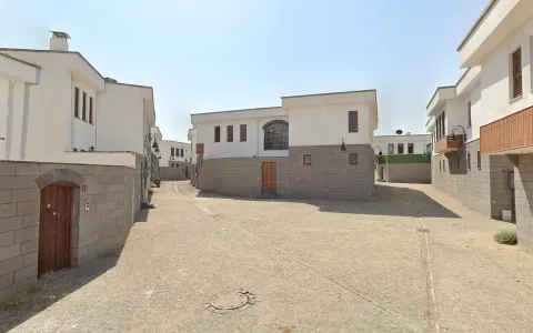
Villages in more remote and mountainous parts of the Southeast, particularly in provinces like Siirt and Bitlis, have a distinct architecture consisting of flat-topped, tightly-packed stone houses. These are also identifiable from afar as house clusters look like “steps” on the mountainside.
These larger blocks made of volcanic stone are very common in the architecture of Kayseri.
They come in a number of colours, most uniquely pink, and often feature “quoins” (prominent corner stones).
Because of the volcanic nature of Uşak, stone houses are more common here than other parts of Western Turkey. These are either white-beige, with a mix of large and small stones, or made of darker brown-grey stone. Quoins are common too. (This looks similar to houses in some regions further east such as Konya, however Uşak is the only region where this type of stone is abundant outside of mountains).
Within Ankara you can find many large townhouses, often with triangular roofs and sharp painted and/or mosaic patterns.
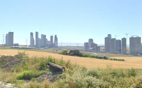
Meanwhile the outskirts of Ankara are infamous for their urban sprawl, with strange skyscraper cities in the middle of Central Anatolian nothingness.
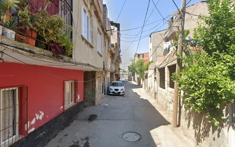

Adana has an almost “LatAm” vibe. It’s quite a poor city, with narrow streets and small concrete houses with limited ornamentation for a Turkish city. This can be similar to some other cities however those tend to have their poorer areas in hillier parts, whereas Adana is dead fiat.
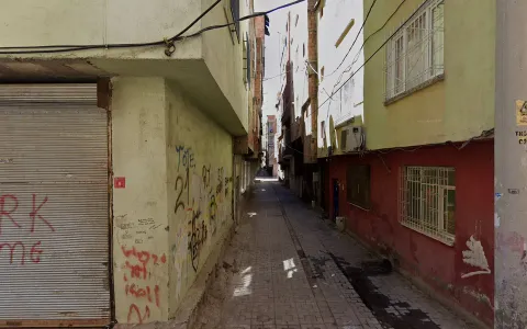
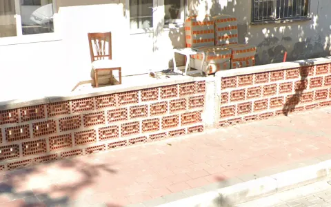
The city of Diyarbakır is one of the poorest cities in Turkey and the largest in the southeast, consequently, it has many slums. These differ heavily from those in Adana however, with equally narrow streets but far taller buildings creating lots of dark alleys. The pavement visible in the image is unique to these slums.
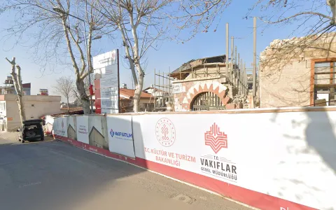
The old center of Diyarbakır however is a very strange place. Much of it was destroyed during the Turkish-Kurdish conflict in 2016 and now much is being rebuilt in this unique, oddly clean, modern style, with a lot of dark grey clean-cut bricks.


Older buildings in the city of Kars will usually be made of this unique black tuff.

Kahramanmaraş was the worst-affected city by the 2023 earthquake. As a result, even though a lot of the coverage was taken two years later, you will still find a lot of rubble, construction sites and empty lots here. (Similar scenes can be seen less frequently in neighbouring provinces)
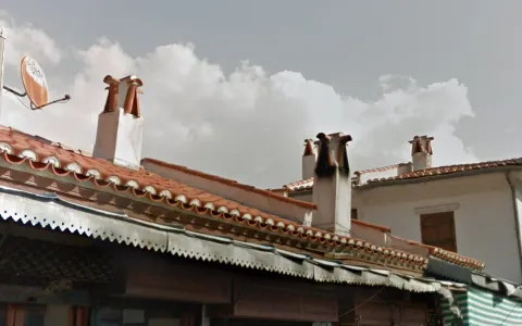
The city of Muğla (and to a lesser extent other towns in Muğla province) have these very unique chimneys which have openings on four sides and little flashings on top.

This type of brick with two big holes and lots of small holes in it is commonly used for walls in Canakkale city, and to a lesser extent elsewhere in the province.

Houses on Bozcaada feature many brightly coloured houses with wooden shutters and often wooden second floor façades.

The Prince Islands off the coast of Istanbul are famous for their predominantly wood panel, all-white, elegant architecture. The islands are also car-free, so the only vehicles you’ll see will be trikes and bikes.
Cultural
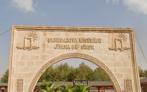
Kurds are an Iranic ethnic group that populate much of southeastern Turkey. In some of the most Kurdish provinces such as Mardin, Şırnak, Hakkâri or Diyarbakır you can occasionally find signage in Kurdish. Kurdish bilingual road signs are particularly common in Diyarbakır and less so in Mardin. The Kurdish language is identified by the presence of circumflex accents (e.g. ê, î) as well as letters that Turkish lacks such as ‘q’, ‘w’ and ‘x’.
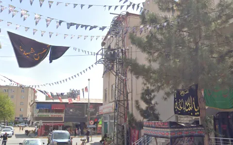
Iğdır is the only Shia-majority province of Turkey (not counting Alevis/Alawites). In Shiite areas you will often see black flags with Arabic slogans on them (even without sometimes), as well as pictures of Husseyn.
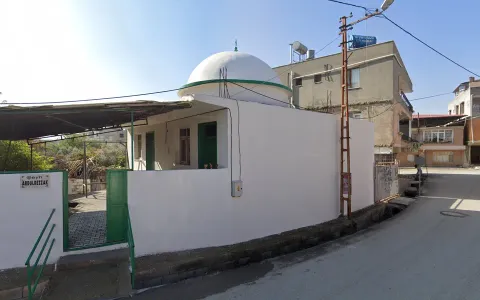
Alawites are a unique sect within Shiism who are pretty much only found in Hatay (especially southern Hatay). Their mosques look completely different, usually being small, lacking a minaret, and painted all white, often with green highlights.
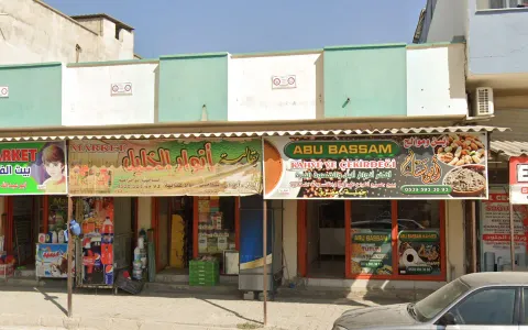
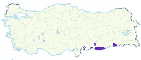
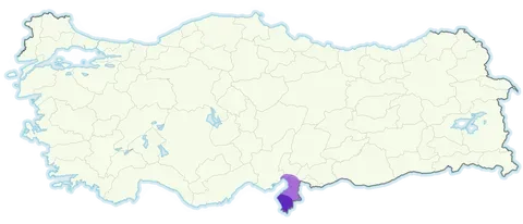
There is a substantial Arab population living in certain border provinces like Şanlıurfa, Kilis and Mardin, as well as large numbers of refugees in those regions. These are most common in the border towns of Akçakale and Nusaybin, and to a lesser extent in Şanlıurfa and Kilis.
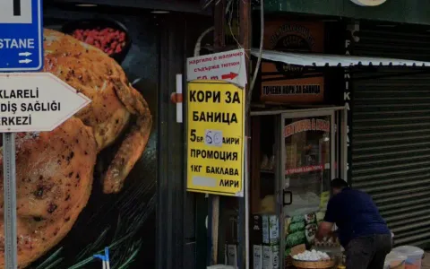

In towns near the Bulgarian border you can sometimes find Bulgarian translations on signs.

In Antalya and nearby tourist resorts you will sometimes find Russian signs as the area is very popular with Russian tourists.
Infrastructure
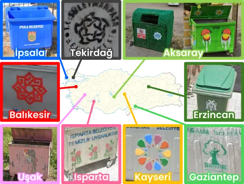
Some cities have unique designs on their dumpsters which can be recognised from afar.
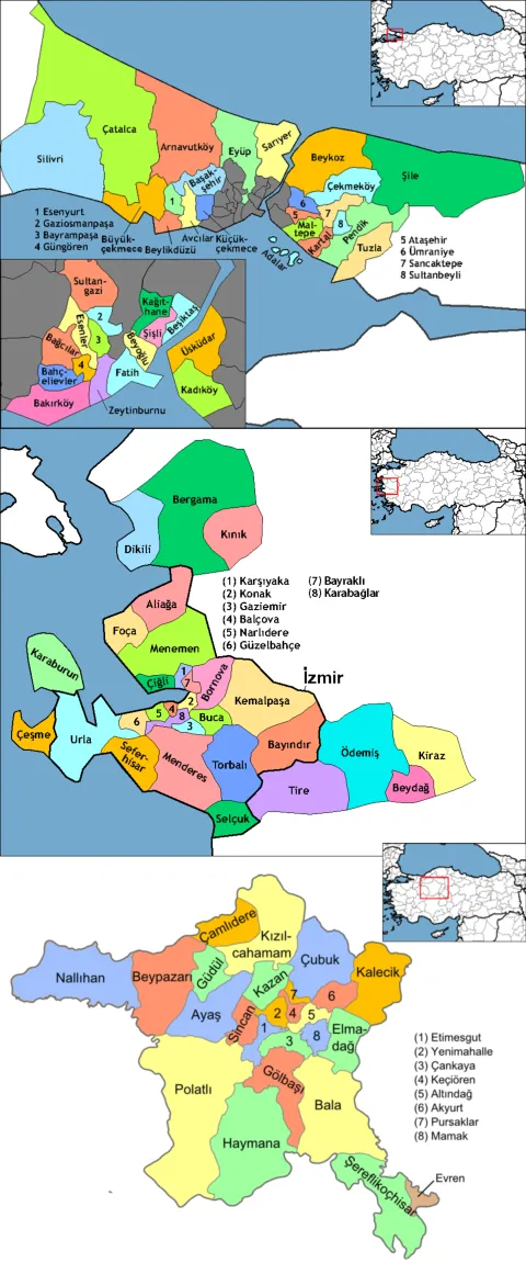
Certain large cities are covered by ghost municipalities which do not cover the same name. It is worth learning these as trash bins and street signs will show a name that does not appear on the map. The most important of these includes:
- Altınordu = Ordu
- Artuklu = Mardin
- Efeler = Aydın
- İlkadım = Samsun
- Menteșe = Muğla
- Ortahisar = Trabzon
- Süleymanpaşa = Tekirdağ
- Şehzadeler = Manisa
Cities divided between two municipalities:
- Balıkesir = Karesi (north), Altıeylül (south)
- Denizli = Pamukkale (east), Merkezefendi (west)
- Eskișehir = Tepebaşı (north), Odunpazarı (south)
- Gaziantep = Şehitkamil (north), Şahinbey (south)
- Kahramanmaraş = Dulkadiroğlu (east), Onikişubat (west)
- Kayseri = Kocasinan (north), Melikgazi (south)
- Malatya = Battalgazi (north), Yeşilyurt (South)
Cities divided between 3+ municipalities:
- Adana = Çukurova (north), Seyhan (east), Yüreğir (west), Sarıçam (further west)
- Antalya = Muratpaşa (center), Aksu (east), Kepez (north), Konyaaltı (west)
- Bursa = Osmangazi (center), Nilüfer (west), Yıldırım (southeast), Gürsu (northeast), Kestel (further east)
- Diyarbakır = Sur (east), Bağlar (southwest), Kayapınar (west),
- Yenişehir (northwest)
- Erzurum = Aziziye (northwest), Yakutiye (northeast), Palandöken (south)
- Konya = Selçuklu (north), Meram (west), Karatay (east)
- Mersin = Yenișehir (center), Toroslar (north), Mezitli (southwest), Akdeniz (southeast)
- Sakarya = Adapazarı (center), Serdivan (west), Erenler (east)
- Şanlıurfa = Haliliye (northeast), Eyyübiye (southeast), Karaköprü (west)
- Van = İpekyolu (center), Tușba (north), Edremit (south)
In the case of Istanbul, Ankara and İzmir, those cities are divided into too many municipalities, although professional players may consider learning them for pinpointing.
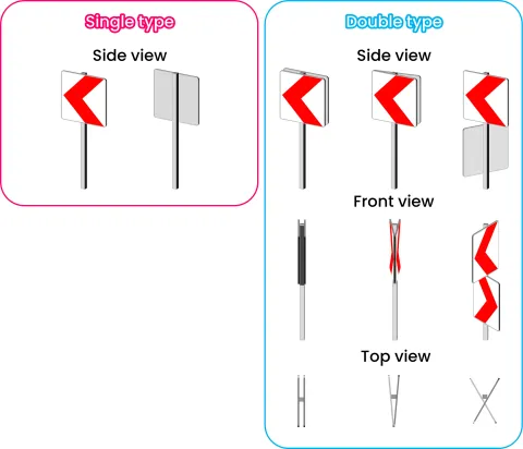
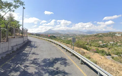
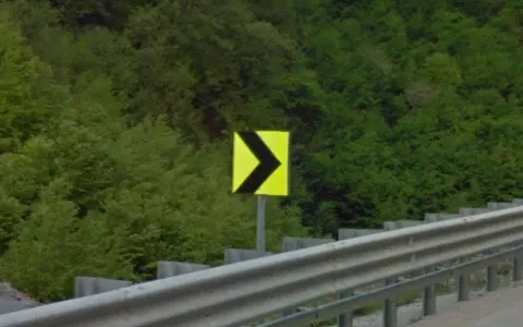
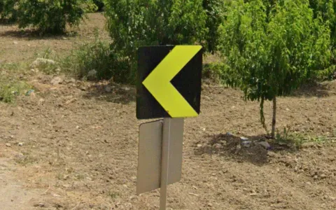
There are two types of chevrons in Turkey: single type and double type. Single type chevrons have one plate on a post, while double type chevrons have two plates on a post. Single type chevrons are usually seen in pairs at the curves of the roads.
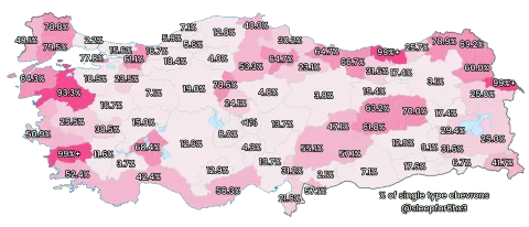
Single type chevrons can be found across the country, but they are more common in the northeast and along the Mediterranean coast. Especially in Balıkesir, Aydın and Trabzon, most of the chevrons are this type. They still exist in the central part of the country, but are rare.
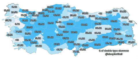
Conversely, double type chevrons are more common in inland provinces.
Note
These tips cannot be applied for chevrons with multiple arrows and ones on divided highways, which are usually single type regardless of the provinces.
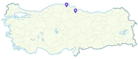
The very rare black on yellow chevron can be found along a stretch of the D785 in Sinop province and an even smaller stretch of the D030 in Samsun province.
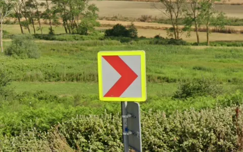
Chevrons with yellow edges are found mainly in four provinces: İstanbul, Sakarya, Bursa in the northwest, and Adana in the south. They are rarely found in other provinces.
Note
İstanbul, Bursa and Adana mainly use double type chevrons. When you see single type chevrons with yellow edges and the landscape does not look Mediterranean, you are likely to be in Sakarya.
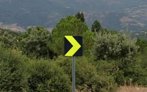
Single type yellow on black chevrons are almost exclusive to Balıkesir province.
Double type yellow on black chevrons are almost exclusive to the Bursa province.
Note
In Çanakkale province, yellow on black chevrons are found almost only on divided highways.
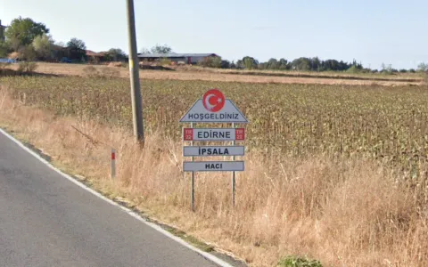

The province of Edirne has these unique town entry signs with a trapezoid welcome sign followed by the province name, followed by the district, followed by the municipality.
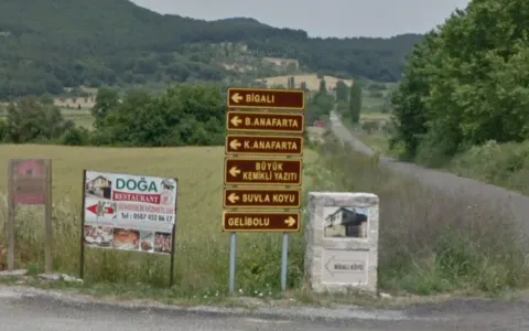

The Gallipoli peninsula (the European part of Çanakkale province) is famous for the WWI battles fought between Anzac forces of the British Empire and the Ottoman Empire. You will often find unique yellow-on-brown road signs here indicating tourist sites. There is also ample trekker coverage of the military cemeteries here, so if you get a cemetery trekker, go Gallipoli.
Toponymy